I believe this route follows the classic Newlands Horseshoe, from Robinson to Catbells, via Hindscarth, Dale Head, High Spy and Maiden Moor; car parked at Little Town. I chose this direction (starting at Robinson) preferring to begin at the higher end of the route. Taken in the other direction there's a bit of a hard slog up from Dalehead Tarn to the summit of Dale Head, and I was happy to meet it in descent, rather than ascent! Choosing to finish at Catbells also means a very gentle finish, being very easy going from Dalehead Tarn back to the car-park. Either way, I think you really can't go wrong with this route - it's a good one!
Newlands Horseshoe, 19km, and around 6 hours. (Wainwright Book 6: The North Western Fells)
Map
It was Wednesday 16th May 2012. This walk took me to six "Wainwrights", all new additions to my bagging list. The count is now 80.
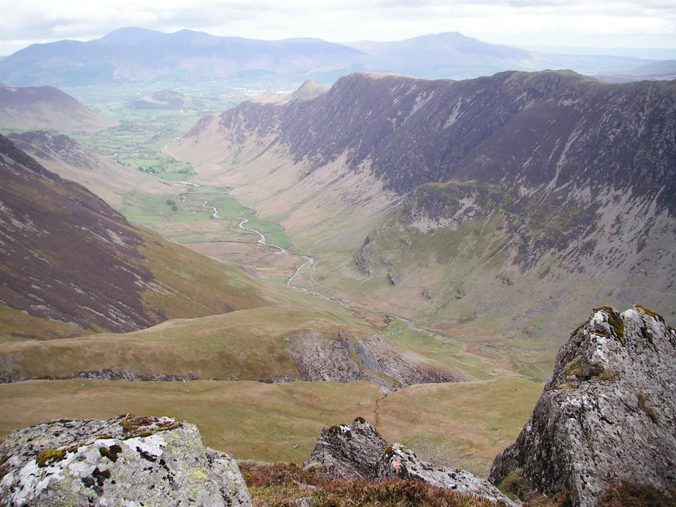 View above Newlands towards Catbells, seen from Hindscarth Edge.
"Scenes of great beauty unfold on all sides, and they are scenes in depth to a degree not usual, the narrow summit [Catbells] permitting downward views of Borrowdale and Newlands within a few paces."
Route Summary
Park at Little Town / Chapel Bridge (or somewhere in the vicinity) and follow the lane to Low High Snab. At the final gate on the lane, turn up onto the ridge of High Snab Bank and follow it to the summit of Robinson. Descend to the south, joining the ridge marked Littledale Edge and head up to Hindscarth. Again, descend to the south, and follow the ridge marked Hindscarth Edge to the summit of Dale Head. Here the path becomes a steep descent to Dalehead Tarn. Cross the stream and begin to turn north. Follow the natural line of High Spy, Maiden Moor and Catbells. Descend Catbells to the west, and join the gravel farm track that leads back towards Little Town.
Little Town to Robinson
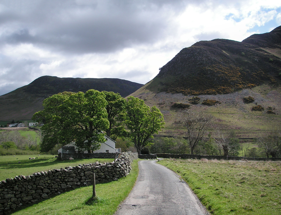 Leaving Little Town, along a paved road until you reach Low High Snab.
There is free parking in a layby at Little Town, just east of Chapel Bridge, but it has fairly limited spaces. The roads are narrow and seem to offer very few opportunities for additional parking. On a previous route to Causey Pike I parked at Uzzicar, which seemed more spacious and was easier to get to, but it would add about 4 or 5 km to this route. I believe there is also a car-park at the north end of the Catbells ridge - not sure what that one's like. Wherever you park, head for the start of the ridge marked High Snab Bank.
I began at Little Town, crossing Chapel Bridge, and following the tarmac road past the chapel as far as Low High Snab. There it becomes a stony farm track leading into the Scope Beck valley.
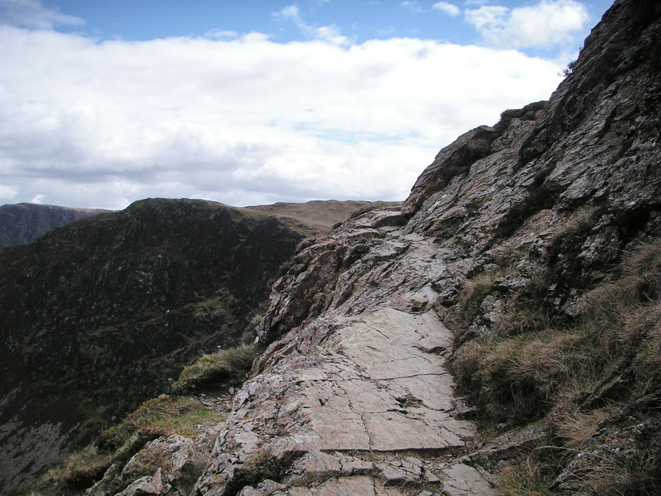 Easy scrambling over Blea Crags, heading towards Robinson.
"There is great diversity of scene during the climb and the views in retrospect are very beautiful, while an exciting fresh panorama opens up when the summit is reached."
After an initially steep and grassy start to gain the ridge, it's easy going all the way to Robinson, with just a few small rocky sections to scramble over. Exposure in minimal, but keep in mind that Robinson does have some very steep crags on its northern side. There are great views back over Newlands throughout, and into the Scope Beck valley with the imposing wall of the Hindscarth ridge behind. Whilst the summit might be rather flat, it's sufficiently high that it provides an ideal vantage point looking over the Buttermere valley, over the Haystacks to Red Pike ridge, towards Pillar and beyond.
The Hindscarth diversion, and Dale Head
The summit of Robinson appears rather flat and barren, but there are a couple of nice cairns/shelters to rest in. Care needs to be taken if leaving the summit to the north as there are some steep crags in that direction. However, my route took me due south, following the fence down to Littledale Edge. The path I followed up the west side of Hindscarth is not marked on my OS map, but is clearly visible on the ground.
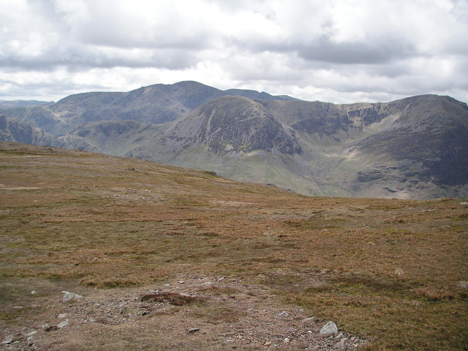 From below Robinson summit, looking towards High Crag and Pillar.
Incorporating Hindscarth into this route requires a minor and fairly painless diversion. You only need to re-trace your steps for about 100 metres near the summit, and apart from this, it follows a natural diagonal up and down either side of the ridge, so definitely no excuse for missing it out!
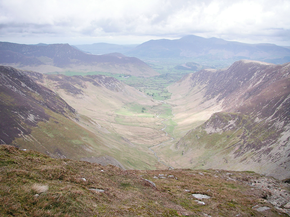 View from Dale Head.
"Dale Head has much in common with Eel Crag in the Grasmoor group. Their summits are focal points of high country, the meeting place of ascending ridges."
Dale Head is a tremendous viewpoint and the photos really don't do justice to the sense of scale as you look down into the valley. The descent to Dalehead Tarn is steep. As with Hindscarth, the natural line of the path is clear on the ground, but is not shown on my OS map. It follows the edge to Dalehead Crags, then turns east and passes to the northern side of Dalehead Tarn.
High Spy to Maiden Moor
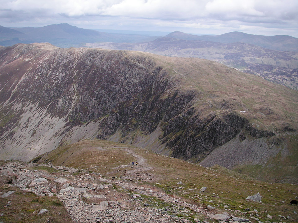 Steep descent from Dale Head to Dalehead Tarn, looking towards High Spy.
I took the path to the north of Dalehead Tarn and crossed Newlands Beck. Here the path turns north towards High Spy. There looks to be some excellent spots for wild-camping around the tarn; definitely one to keep in mind.
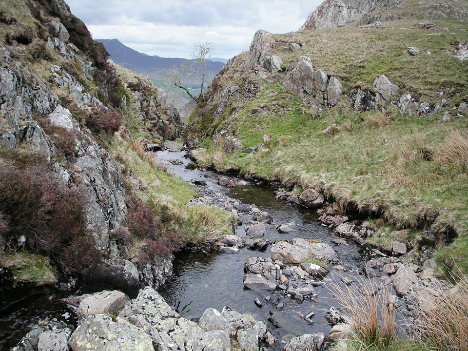 Looking down Newlands Beck, below and to the east of Dalehead Tarn.
Compared to the descent from Dale Head, it's a gentle climb from here up to the summit of High Spy. The path is clear, but it's worth a minor detour to look over Miners Crag; impressive in it's own right and with great views into the valley. This is my only accent of High Spy, but it looks like it's flanked by equally impressive crags to the eastern side.
"High country can rarely be appraised properly from valley level, however."
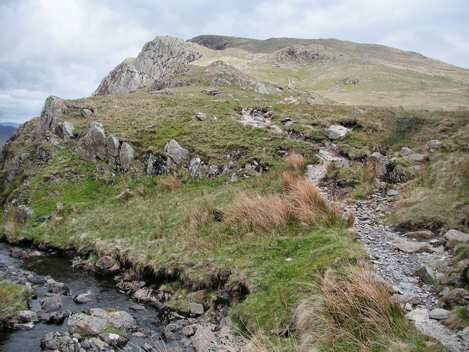 View from Newlands Beck, east of Dalehead Tarn, towards High Spy.
From the summit of High Spy, there is almost no ascent left in this direction, and it's an easy walk down to Catbells via Maiden Moor. Do take the advice from the Wainwright guide and take a short detour to visit the cairn above Blea Crag. The views over Derwent Water are excellent.
Catbells to Little Town
To the north of Maiden Moor the path becomes a very well maintained track. It feels slightly inclined to the eastern side of the ridge, with great views over Derwent Water.
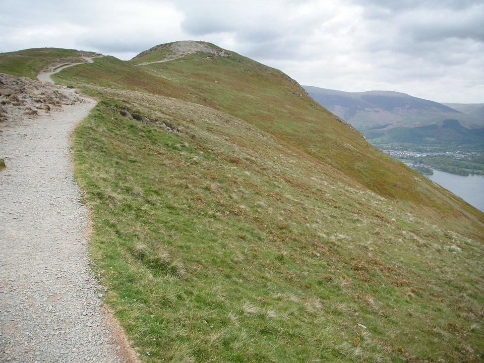 Well trodden and well maintained path to Catbells.
Catbells is a classic Wainwright for good reason, being a fairly narrow ridge with excellent views in every direction. Descending to the north, the path begins steep and starts to level out around 350m, and here I left the main path to the west and took a steep grassy track that led me back to Little Town. It's very easy going, although the grassy section might be prone to become slippery when wet.
Conclusion
Despite its fairly lowly 451 metres, Catbells is rightly a classic amongst the Wainwrights. My opportunity for visits to the Lake District are somewhat limited, and my preference is to include several summits in each trip. However, it's a fine mountain in its own right, with plenty of paths from east, west or north, and it would be easy to make it the highpoint of a short circular walk.
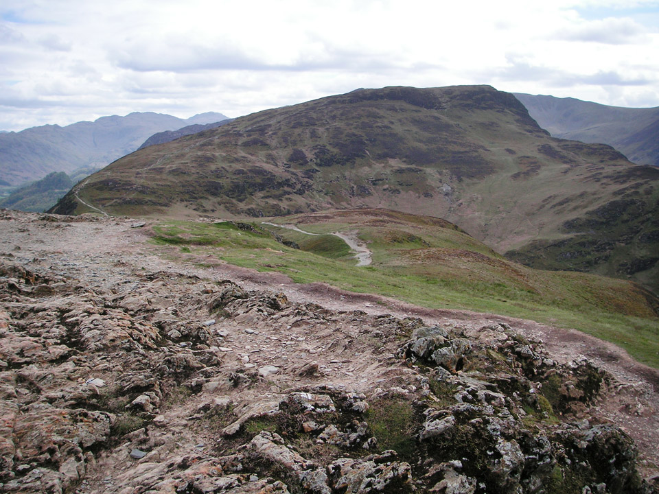 From summit of Catbells, looking back at Maiden Moor.
I have no hesitation in recommending this horseshoe. It could easily be lengthened to include Ard Crags and Knott Rigg, ascending Robinson via Buttermere Moss, or there are half a dozen possible routes to Dalehead Tarn, giving the option to omit Robinson, Hindscarth, and/or Dale Head. But at 19km, I think this makes for a nice easy day-walk and it's well worth doing this full circuit.
"...to those who travel alone, the solitary wanderers on the fells, who find contentment in the companionship of the mountains."

